


Login to Continue Learning
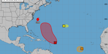
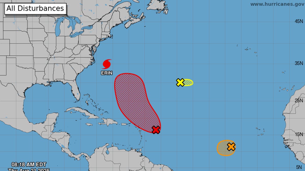
According to the National Hurricane Center (NHC), an area of showers and thunderstorms east of the Leeward Islands is expected to strengthen over the weekend. Environmental conditions appear favorable for further development, with a tropical depression likely to form near or north of the northern Leeward Islands by this weekend.
If wind speeds reach 39 mph, it will be named Tropical Storm Fernand, making it the sixth named storm of the 2025 Atlantic hurricane season. Currently, the system is marked on NHC maps with a red “x.”
Although the Atlantic remains active through August, forecasters do not foresee significant land threats from these systems at this time.
The upcoming disturbance could bring squally weather and increased storminess to northeastern Caribbean islands, including Puerto Rico and the U.S. Virgin Islands, over the next few days. However, it is unlikely to develop until after it moves away this weekend.
Related Post


Far out in the Atlantic, another disturbance (Invest 99L) is also being monitored but is expected to face challenging conditions that may prevent further development.
In addition, a small area of low pressure southwest of the Azores is producing limited showers and thunderstorms. However, upper-level winds are only marginally conducive for development over the next couple of days as the system moves slowly eastward.
Looking ahead, unfavorable upper-level wind conditions are expected to develop this week over the Atlantic’s Main Development Region, indicating a quieter period in the tropics through late August and early September.


