


Login to Continue Learning
The Texas Hill Country is known for its rugged landscapes, where shallow rivers wind among hills and through valleys. However, this unique geography makes it one of the deadliest regions in the U.S. for flash flooding.
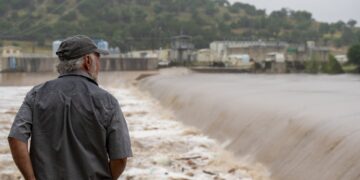
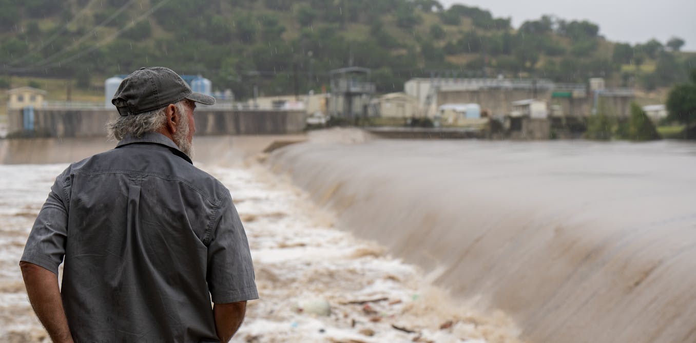
In early July 2025, a devastating flash flood swept through an area of Hill Country that included summer camps and small towns about 70 miles northwest of San Antonio. More than 135 people died in this flooding event, with most victims in Kerr County. The majority were at Camp Mystic, where over two dozen girls and counselors lost their lives. By the following week, dozens more individuals remained unaccounted for.
The flooding began with a heavy downpour, producing over 10 inches of rain in some areas. This sent water quickly cascading off hillsides into creeks, which then poured into the Guadalupe River. A river gauge near Camp Mystic showed how rapidly the Guadalupe flooded: around 3 a.m., the river was rising about 1 foot every 5 minutes. By 4:30 a.m., it had risen more than 20 feet and reached Kerrville, where the water rose even faster.
Flood expert Hatim Sharif, a hydrologist and civil engineer at the University of Texas at San Antonio, explains why this area is so prone to flash flooding. Texas leads the nation in flood deaths, with over 1,069 fatalities from 1959 to 2019. Many of these occurred in Hill Country.
Related Post


The hills are steep and the water moves quickly during floods. This semi-arid region has soils that don’t absorb much water, causing it to sheet off rapidly and filling shallow creeks fast. When these creeks converge on a river, they create a surge that can wipe out homes, wash away cars, and unfortunately, anyone in its path.
Hill Country has experienced some devastating flash floods. In 1987, heavy rain in western Kerr County triggered a similar flood, claiming ten teenagers’ lives as they were evacuated from a camp. On June 12, 2025, San Antonio was hit by a flash flood that killed 13 people whose cars were swept away by high water near an interstate ramp.
One reason for such strong downpours is the Balcones Escarpment, a line of cliffs and steep hills created by a geologic fault. When warm Gulf air rushes up this escarpment, it condenses and can dump large amounts of moisture. This water flows down quickly in many directions, filling streams and rivers below.
As temperatures rise, warmer atmospheres hold more moisture, increasing the risk of heavy downpours and flash flooding. The same effect contributes to San Antonio’s flash flood risk due to its high amount of paved land and lack of updated drainage systems.
Improving flash flood safety involves educating people about why these events happen and how fast water can rise and flow. Drivers should be aware that even a foot or two of moving water can wash away a car, and they shouldn’t assume their trucks and SUVs are immune to flood risks. Officials could also do more to barricade roads during high flood risk periods to prevent people from driving into harm’s way.
Education is particularly crucial for drivers, as fast-moving water can flip vehicles and carry them away. Improving flood forecasting with detailed models and implementing probabilistic forecasting can help authorities prepare for worst-case scenarios. A scientific framework linking rainfall forecasts to local impacts could also assist decision-makers in implementing timely evacuations or road closures.
This area’s vulnerability to flash flooding highlights the need for better education, improved infrastructure, and enhanced emergency response measures to protect lives and property.
📚 Reading Comprehension Quiz
What was a key factor in the rapid rise of the Guadalupe River during the flash flood event in July 2025?
Please login or register to take the quiz and earn points!


