


Login to Continue Learning
Tropical Storm Fernand is currently moving through open waters in the central Atlantic and is not posing an immediate threat. However, forecasters at AccuWeather warn that the hurricane season, which began on June 1 and ends on November 30, might intensify soon.
“Sometimes you can have these lulls in the middle of the hurricane season,” explained Alex DaSilva, a lead hurricane expert for AccuWeather. “It looks like we are going to be having one at least across the main storm development region.”
During the first week of September, there will be a lot of sinking air, which can suppress storm formation. But starting in the second week of September, vertical motion is expected to increase, making it crucial to monitor tropical waves closely.
For now, even any developing tropical waves in the eastern Atlantic are being suppressed by dry air.
Related Post


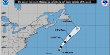
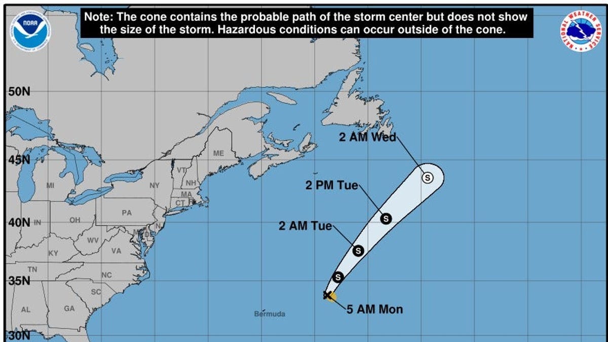
Tropical Storm Fernand, which followed behind Hurricane Erin, is currently driving winds at almost 60 mph and is forecasted to weaken further on Tuesday before becoming a post-tropical cyclone without making landfall.
“The good news is it has trended east,” DaSilva noted. “Nothing to worry about with this one; it’s going out to sea.”
Despite initial warnings, the storm’s path is now safely away from Bermuda and poses no immediate threat.


